Mapping biodivers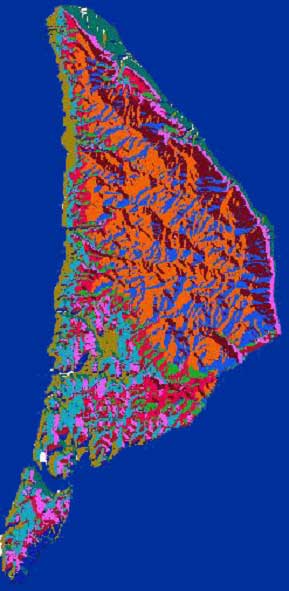 ity using climatic and physiographic surrogates at a local scale
Liron stoller-cavari
Efforts to preserve biological diversity are increasingly focused upon ecosystems rather than species, primarily because direct surveys of species distribution and abundance are expensive and time consuming. Moreover, our knowledge of species distributions based on such surveys is patchy and incomplete, both in terms of geographical coverage and in terms of taxonomic coverage (there are simply too many species to handle on a species-by-species approach). Therefore the resulted distribution maps are misleading. The objective of the present study is to develop a reliable and simple tool to represent regional and local biodiversity. My approach assumes that environmental factors such as climate and topography determine species distributions. Therefore, planning and monitoring of reserves effectively might focus directly on obtaining a good representation of the environmental pattern as a surrogate for Biodiversity. Classification methods were introduced in previous studies as a useful tool for producing a set of groups that are complementary; each group representing a different and unique portion of the entire environmental domain. I compared the biodiversity representation efficiency of two different approaches for delineated boundaries of mapped land classes: (1) human based classification or expert knowledge classification (2) computerized classification method using K-means partitioning algorithm. Both methods used one or more measurable environmental characteristics as the input data for the classification procedure. In order to apply the first approach, I used a map of geographical units and a map of vegetation units, whereas the product of the second approach was a map of land units. In order to verify the validity of land classes as complementary sets of biological entities, I collected actual data for three functional groups of species: woody plants, geophytes and land snails. A total of 330 sampling units were surveyed in 110 locations across the study area. Mantel randomization test was used for calculating the association between the mapped land classes and the biological entities against random distribution. The analyses were undertaken for each functional group separately. The results showed low but significant positive correlation between Environmental Diversity (ED) and Biodiversity (BD). The land units map performed best, as it captured pattern of species composition of more biological groups than the two other ED maps. To summarize, this work represents a systematic, repeatable and relatively objective method for landscape classification which can be used for planning and monitoring purposes.